

Underground Imaging Systems and Technologies
Discovering the world hidden beneath our feet is no longer a mystery. Underground imaging systems, developed through the fusion of modern engineering and geophysical science, allow you to detect subsurface structures, cavities, metals, and water resources with high resolution. Whether it is an archaeological excavation, mineral exploration, or a pre-construction soil survey, you can prevent loss of time and cost by using the right underground imaging devices.
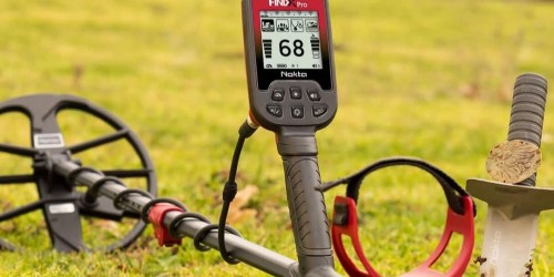
What Are Underground Imaging Devices and How Do They Work?
Underground imaging devices convert physical changes beneath the soil into data through sensors and specialized software. These systems typically utilize technologies such as magnetometers, gradiometers, or GPR (Ground Penetrating Radar).
These devices analyze the return time and intensity of the signals sent into the ground to create a depth map. This allows for the digital visualization of underground anomalies—such as cavities, tunnels, pipelines, or buried objects—in 2D or 3D before any excavation begins.
Areas of Use for Underground Imaging Systems
As technology advances, the range of applications for these systems continues to expand. The primary areas of use include:
-
Archaeology and Treasure Hunting: Locating historical ruins, burial chambers, and ancient structures without causing damage.
-
Geophysics and Mining: Tracking mineral veins, detecting water tables, and analyzing rock structures.
-
Construction and Infrastructure: Pre-construction site analysis, mapping underground cables, and identifying sewage lines.
-
Military and Security: Detection of underground tunnels and locating unexploded ordnance.
What to Consider When Choosing the Best Underground Imaging Device?
Identifying your project's specific needs is the most important step when purchasing or renting an underground imaging device. Here are the critical points to consider:
1. Depth Capacity
The signal strength of every device varies. While high-frequency devices are preferred for shallow objects, systems that transmit low-frequency but powerful signals should be selected for significant depths, such as 10–20 meters.
2. Soil Composition Compatibility
Rocky, clayey, or highly mineralized soil structures can affect device performance. Ensuring that the underground imaging systems you choose feature automatic ground balancing and advanced filtering will help you eliminate false signals (noise).
3. 3D Data Analysis and Software
Unlike standard detectors that only provide audio alerts, professional imaging systems visualize the data. Thanks to advanced software, you can estimate not only the location of an object but also its depth, shape, and size.
Map the Subsurface with Professional Solutions
In our underground imaging systems category, you can find the latest models from world-renowned brands at the forefront of technology. With user-friendly interfaces, long battery life, and high-precision scanning features, our devices deliver clear results even in the most challenging field conditions.
Why Choose Our Systems?
-
High Sensitivity: Sensor technology that captures even the smallest anomalies.
-
Training and Support: Technical assistance regarding device operation and data analysis.
-
Durability: Rugged body designs resistant to dust, water, and impact encountered in the field.
Sıkça Sorulan Sorular
How many meters deep can underground imaging devices see? Depending on the device technology and soil structure, there are professional systems available that start from 2 meters and can reach depths of 25–30 meters.
What is the difference between GPR and a metal detector? While metal detectors only identify conductive metals, underground imaging systems can detect and 3D model non-metallic objects such as cavities, structures, water, and marble.
Which device is right for me? If your target involves large structures and deep cavities, you should prefer gradiometer systems; for shallower and detailed objects, GPR systems are more suitable. You can contact our expert team to determine the most appropriate device for your project.
")