A New Era in Underground Imaging: Mala GPR GeoDrone 80 and UAV Technology
In today’s geophysical research and engineering projects, accessing subsurface data is no longer limited to ground-based operations. Advancing technology has brought Ground Penetrating Radar (GPR) systems to the skies, making it possible to scan previously inaccessible areas. As a pioneer of this innovative era, the Mala GPR GeoDrone 80 allows you to conduct underground imaging processes much faster, safer, and with high precision.
A New Dimension in Ground Penetrating Radar (GPR) Technology
Ground-penetrating radars play a critical role in detecting underground structures, pipelines, cables, or archaeological remains. However, rugged terrains, marshes, avalanche-prone areas, or dense vegetation often restrict the use of traditional ground-coupled GPR devices.
The Mala GPR GeoDrone 80 is specifically designed to overcome these obstacles. Thanks to advanced MALÅ HDR GPR Technology, it minimizes signal loss even during aerial scanning and delivers crystal-clear data quality.
Professional Solutions in the Black Sea Region with Cotyora Detector
Providing underground imaging services in the challenging geographical conditions of the Black Sea requires expertise. Cotyora Detector meets the professional underground research needs in the region by utilizing Mala GPR GeoDrone 80 systems.
With its modern equipment fleet and experienced technical staff, Cotyora Detector is the most reliable solution partner for both individual users and corporate projects (construction, archaeology, infrastructure). In the difficult Black Sea terrain, it performs underground mapping operations without taking risks and with a zero-error margin.
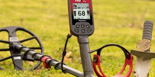
Key Features of the Mala GPR GeoDrone 80
The Mala GeoDrone 80 is not just a drone attachment; it is a fully integrated engineering marvel. Key features that set this device apart from its competitors include:
MALÅ HDR GPR Technology: Superior data collection capability at greater depths compared to traditional GPR devices, thanks to High Dynamic Range (HDR).
Universal Drone Compatibility: Full compatibility with all standard industrial drone models with a payload capacity of 3.5 kg or more.
Wireless Data Transmission: GPR data is transmitted wirelessly to the ground control unit (tablet/computer) during operation.
Autonomous Survey Support: Automated data collection via a pre-defined flight path removes human error.
Durability in Hazardous Conditions: Safe operation in areas where human access is restricted, such as river crossings, steep slopes, and hazardous waste sites.
Technical Specifications and Performance Data
The Mala GeoDrone 80 maximizes operational efficiency with its lightweight structure and powerful antenna frequency.
Feature
Details
Core Technology
MALÅ HDR GPR (High Dynamic Range)
Antenna Frequency
80 MHz (Optimized for deep penetration)
Weight (Without Battery)
2.31 kg (Lightweight and balanced design)
Operating Time
3+ Hours (Continuous operation with dual batteries)
Dimensions
580 mm x 1040 mm x 240 mm
Positioning Precision
Internal positioning supported by DGPS (SBAS)
Application Areas: Where Is It Used?
The Mala GPR GeoDrone 80 offers a wide range of applications, ensuring a quick return on investment:
Archaeological Discoveries: Mapping underground ancient structures and burial chambers without damaging heritage sites.
Engineering and Infrastructure: High accuracy in pipeline detection, leak detection, and soil survey studies.
Disaster Management: Detection of objects buried under avalanches or inspection of landslide-prone areas.
Geophysical Research: Preliminary detection of rock structures, groundwater levels, and mineral veins.
Forensic Investigations: Rapid scanning for underground evidence and hidden objects in large fields.
Package Content: Complete Field Solution
The system provided under the guarantee of Cotyora Detector includes all the equipment you need the moment you step into the field:
MALÅ GeoDrone 80 Antenna
Battery Packs (11.25V 2950mAh) and Dual Battery Charger
External GNSS/GPS Antenna (For high positioning accuracy)
Samsung Galaxy Tab Active Pro 5G (Pre-configured control unit)
MALÅ Controller App and Specialized Shoulder Strap
Conclusion
The days of having to choose between "speed" and "accuracy" in underground surveys are over. The Mala GPR GeoDrone 80 combines the flexibility of unmanned aerial vehicles with the most advanced radar technology.
If you want to minimize the margin of error in your projects, save time, and easily scan the most difficult terrains, you should meet the advanced technology solutions offered by Cotyora Detector. Solving the mysteries of the underground from the sky is now much easier!
Note: The aerial use of GPR systems is subject to local legal regulations. It is strongly recommended that users obtain the necessary flight and scanning permits from the relevant authorities.
Note:The information stated above is based on the data provided by the manufacturer.